Pier to Annenberg Beach House
A shorter northern escape. Coastal air & a longer pause.
Explore the rideSouth from the pier / Santa Monica coast
People, palms & the Pacific.
Real places, archival photography. Photographers, dates & licenses
The ride
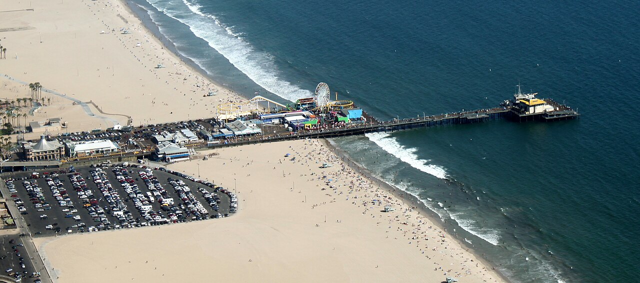
A compact taste of the Los Angeles coast: begin below Santa Monica Pier, follow the beach bikeway south, and pause by Venice Skate Park before retracing your ride. The appeal is the changing waterfront, not a training pace. Make room for a stop and a walk instead of trying to cover the full beach trail.
The GPX begins on the beach-level path at the south side of the pier underpass. Downtown Santa Monica sits above the beach, so getting from a hotel or rental shop to this start is a separate part of your journey. Do not follow a navigation pin onto the pier deck and expect it to be the cycling route.
Original Muscle Beach is an early side stop. It is the gymnastics-oriented Santa Monica site, distinct from the weightlifting area farther south in Venice. Leave the through path before stopping; the GPX stays on the bikeway rather than taking your bicycle into the exercise area.
The mapped turnaround is beside Venice Skate Park. Dismount for a closer look at the waterfront, keep the skate bowls for skaters, and give yourself time for the return. The track does not extend to Washington Boulevard or the on-street connection around Marina del Rey.
Know where you are going
Loading the coastal map...
Planned beach route Places to pauseReport a map issue
Terrain at a glance
The dashed line marks the turnaround. USGS NED ground-elevation samples via OpenTopoData, approximately 10 m resolution. This is not a surveyed path profile: underpasses and small ramps may be missed. No climbing-gain claim is made.
Make time for the stops
Start on the beach-level bikeway, not the pier deck.
Place on Google MapsA side stop near the pier. Park and walk off the bikeway.
Place pin is about 90 m from the track in a straight line, not a measured walking route. Use signed access.
Place on Google MapsWatch from outside the skate bowls. Leave the bikeway on foot.
Place pin is about 40 m from the track in a straight line, not a measured walking route. Use signed access.
Place on Google MapsTurn beside the skate park; the track does not enter the skate bowls. The downloaded track includes the return to the start.
The useful details
Beach path at the south mouth of the Santa Monica Pier underpass. Return to the same point.
A comfortable city bike, hybrid or cruiser is a practical choice. Check fit, brakes and tire pressure before leaving the shop.
An earlier departure leaves more of the day for stops. Crowds and wind vary; neither a quiet path nor a tailwind is guaranteed.
A two-hour booking can leave little margin if you stop often. Add collection, the ride from the shop, and the return deadline to your plan.
Carry your own water. Treat shops and beach facilities as optional stops, not guaranteed open services. Ask the rental shop about its lock and helmet policy before setting out.
Compare nearby bike rentalsTake the route with you
Santa Monica to Venice / 4.4 mi / out & back
GPX 1.1 with 619 track points and named places.
Planned geometry, without fabricated ride times or elevation readings.
A few things worth knowing
No. It is a planned track assembled from connected OpenStreetMap cycleway segments. It contains the outward and return legs, plus named points of interest. We have not field-ridden it or checked same-day closures.
The measured map geometry from the selected start to the turnaround and back. Rental-shop approaches, walks to buildings and optional detours are excluded. GPS devices may calculate a slightly different distance.
Check the exact bicycle class, posted signs and the rules for each jurisdiction. These guides are written for ordinary pedal bicycles. Do not assume that every vehicle sold as an e-bike is permitted; the current Santa Monica police guidance is linked below.
No. These files cover only the described Santa Monica and Venice sections. They do not include the inland connection around Marina del Rey or the rest of the South Bay.
Water, sun protection, a helmet, a lock, a charged phone and the downloaded track. Check brakes and tire pressure. Allow extra time for collecting and returning a rental.
Another way to spend the day
A shorter northern escape. Coastal air & a longer pause.
Explore the rideOne coast, three landmarks. A full beach morning.
Explore the ride