Mount Hollywood Drive
Griffith Park / Demanding / hills
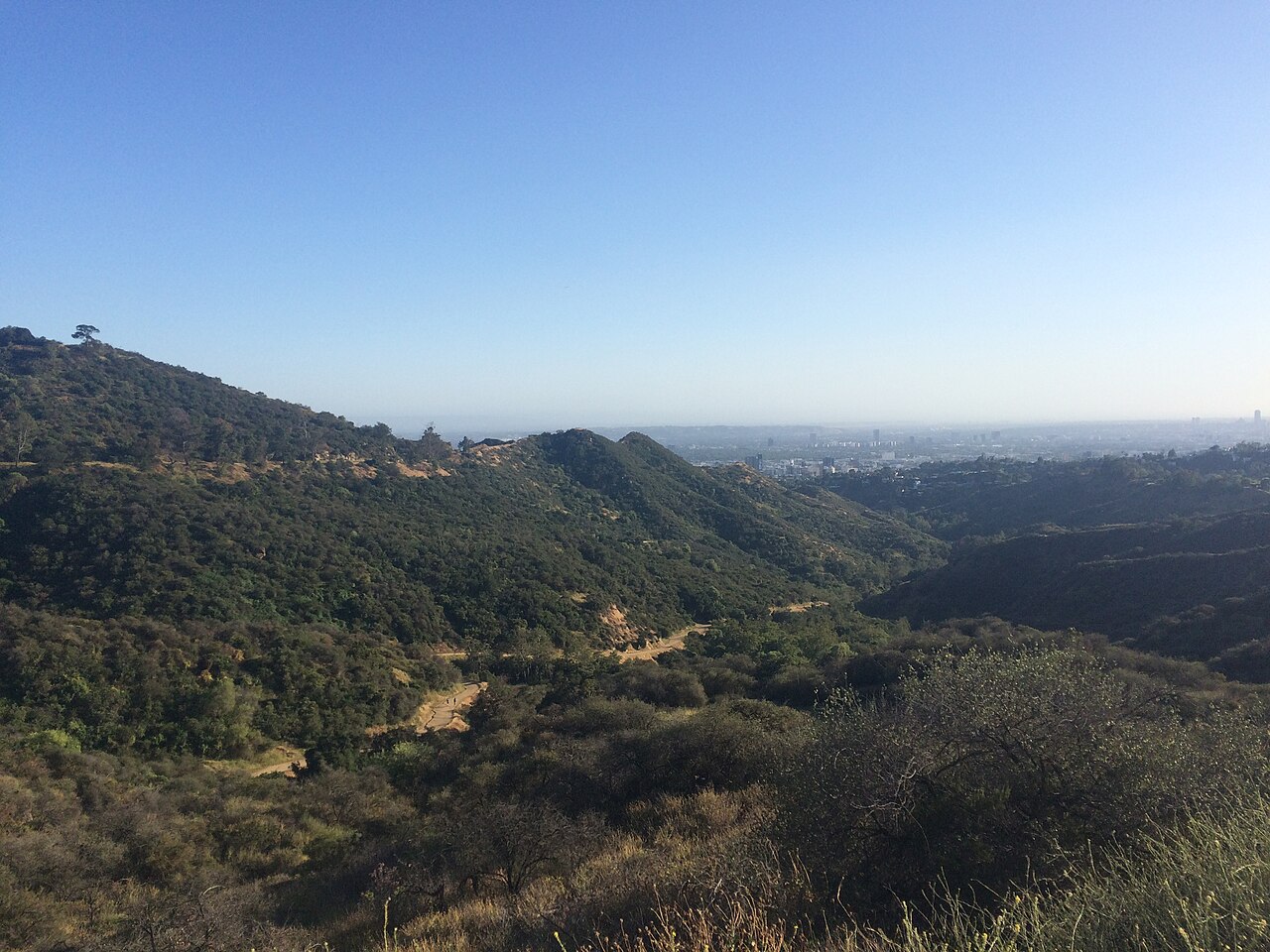
Earn the view above the city. Paved climbing & wide city views.
Explore the rideChannel to coastal junction / Culver City / Marina del Rey
A river corridor, not a beach promenade.
All 2 photographs Real places, archival photography. Photographers, dates & licenses
Know the shape of your day
Ground elevation is the lowest-to-highest sampled terrain, not total climbing gain. Access, surface and traffic are not live-verified.
The ride
Choose this when you want a continuous ride with a clear turnaround rather than a sequence of beachfront attractions. The plan starts on the Ballona Creek bikeway near Overland Avenue, runs downstream to the coastal junction and bridge, then returns. The channel, ramps and junction at the coast make the map more useful than another version of the Santa Monica beach ride.
Join at the Overland Avenue access and descend to the path before starting the track. The GPX starts on the bikeway, not on the road bridge or at a parking space. It deliberately omits the upstream National Boulevard to Duquesne Avenue project area. Construction information is not a guarantee that the downstream section is open: read the city notices and obey any closed gate.
Stay on the signed creek bikeway through the channel corridor. Access ramps, underpasses and faster riders deserve attention even when the route looks straight. Do not enter the channel bed or try to ride around a flood closure. The return uses the same mapped path, so you can shorten the trip at a suitable safe turning point before reaching the coast.
At the coastal junction, follow the mapped connection onto the Ballona bridge and turn at the southern end. This file does not continue along Dockweiler Beach or route you through Marina del Rey. Pause off the through lane before turning, and keep something in reserve for the return: wind can make two equal distances feel quite different.
Know where you are going
Loading the route map...
Planned route Landmarks Coffee & restReport a map issue
Terrain at a glance
The dashed line marks the turnaround. The vertical scale varies by route: compare the numbers, not just the shape. USGS NED ground model via OpenTopoData, about 10 m resolution; not a surveyed riding surface or a climbing-gain measurement.
Make time for the stops
Start on the bikeway after the access ramp; the road approach is separate.
Waypoint on Google MapsStay on the creek path through this mid-ride landmark. The photo is archival.
Waypoint on Google MapsFollow the mapped bridge connection; do not continue toward Marina del Rey.
Waypoint on Google MapsTurn here without blocking the path, then return along the creek.
Waypoint on Google MapsTurn at the south end of the Ballona bridge and retrace the creek bikeway. The downloaded track includes the return to the start.
Food & a place to pause
No on-track cafe is verified in this guide. Bring a drink; make your longer pause off the bikeway near the coastal junction only where access is permitted.
Carry water and a snack for the whole ride. The coastal junction is a navigation point, not a guaranteed cafe or restroom stop. Coffee is a before-or-after plan unless you verify a separate detour.
No cafe pin is shown because an exact suitable stop has not been verified. This is a supply-planning limitation, not a claim that no cafes exist nearby.
Places, surfaces & useful landmarks
Archival photographs, not current conditions. Viewpoints and off-track stops are identified below; they do not prove today's access.
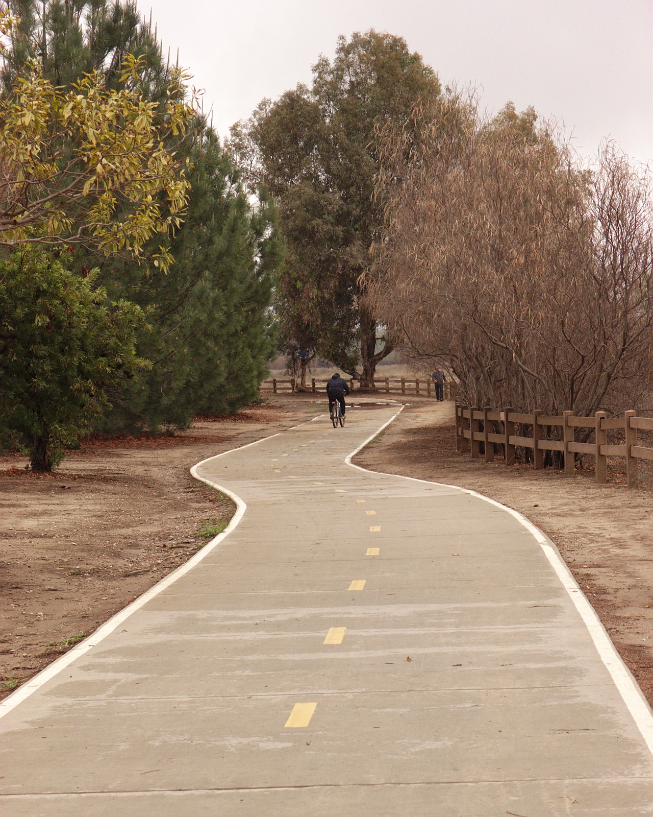
Near Centinela, the paved bikeway runs beside the channel. The center markings and limited space matter more here than beach scenery.
DocFreeman24 , 2021. CC BY-SA 4.0 .
The signed junction with the coastal bikeway is the navigation decision near the turnaround. This ride uses the bridge, then returns up the creek.
Jengod , 2022. CC BY-SA 4.0 .
The useful details
Overland Avenue access to the creek bikeway. The road approach and parking are not included in the GPX.
A hybrid, touring or road bike is suitable for the planned paved geometry; inspect tires and brakes and watch for debris.
Read Culver City construction and closure notices. Never interpret a downloaded route as permission to pass a barrier.
Allow roughly an hour or more of riding, plus a break and your access journey. A strong headwind may require substantially longer.
Carry water and a snack for the whole ride. The coastal junction is a navigation point, not a guaranteed cafe or restroom stop. Coffee is a before-or-after plan unless you verify a separate detour.
Bring a suitable bike. Our Santa Monica rental comparison does not cover this inland start.
Take the route with you
Ballona Creek to the coast / 7.8 mi / out & back
GPX 1.1 with 151 track points and named places.
Planned geometry, without fabricated ride times or elevation readings.
A few things worth knowing
No. It is a planned track assembled from connected OpenStreetMap roads and bicycle-permitted paths. Each file is a full loop or an out-and-back, with named waypoints. We have not field-ridden it or checked same-day closures.
The measured map geometry for one complete described outing, returning to the selected start. Rental-shop approaches, walking detours and extra laps are excluded. GPS devices may calculate a slightly different distance.
These guides are for ordinary pedal bicycles. Check the exact bicycle class, local jurisdiction, park rules and posted signs; permissions differ by location and trail. An e-bike rental offer is not proof that a route allows it.
No. Check the official access links on the guide before leaving. A closure, flood warning or posted restriction overrides the download; never bypass a barrier to follow a track.
Water, sun protection, a helmet, a lock, a charged phone and the downloaded track. Check brakes and tire pressure. Allow extra time for collecting and returning a rental.
Another way to spend the day
Griffith Park / Demanding / hills
Earn the view above the city. Paved climbing & wide city views.
Explore the ridePasadena / Short / road confidence
A repeatable lap, not a closed circuit. A compact Pasadena workout.
Explore the rideSan Fernando Valley / Leisure / crossings
A Valley loop with real junctions. Park edges, open sky & a different part of LA.
Explore the ride